The Bayraktar TB2 UAVs, developed indigenously and originally by Baykar, play a key role in disaster response by providing real-time live imagery and data to crisis centers. This capability supports crucial tasks such as logistics management, traffic regulation, and search and rescue operations during natural disasters, including earthquakes and floods.
Since 2020, Bayraktar TB2 UAVs have also been actively deployed for early detection and efficient management of forest fires. This initiative is made possible through a collaboration with the Turkish Ministry of Agriculture and Forestry’s General Directorate of Forestry (OGM). As a result, Türkiye has become the first country in Europe to employ high-tech UAVs in combating forest fires.
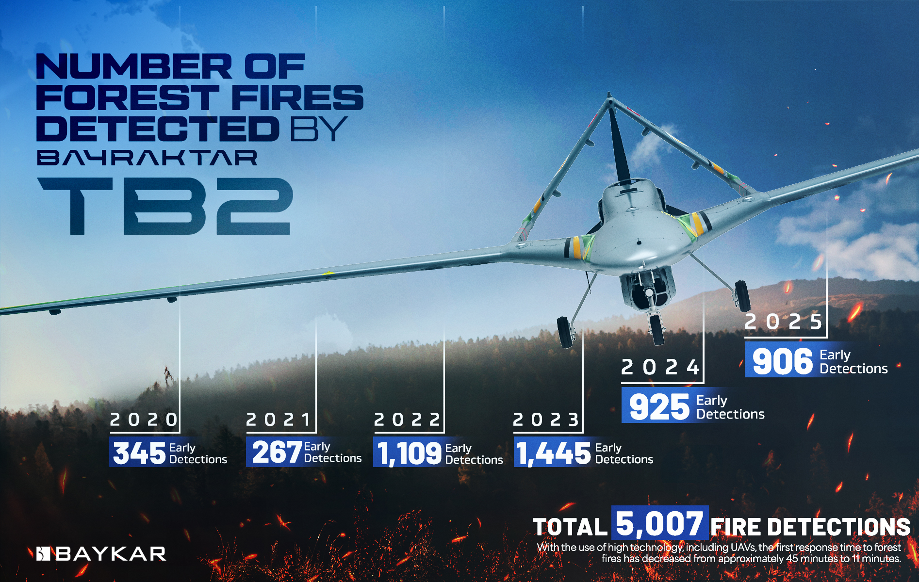
According to the General Directorate of Forestry, Bayraktar TB2 UAVs successfully detected 345 fires in 2020, 267 fires in 2021, 1,109 fires in 2022, 1,445 fires in 2023, and 925 fires in 2024. Altogether, they identified 4,091 forest fires in their early stages, allowing them to be extinguished before they could spread. With this high-tech intervention, the initial response time for forest fires has dropped significantly, from approximately 45 minutes to just 11 minutes.

In 2024, Türkiye’s pioneering and innovative approach to forest fire management continues to grow. Under this initiative, Bayraktar TB2 UAVs now operate from five main centers designated by the OGM

• Adana
• Antalya/Alanya
• Edirne/Keşan
• Manisa/Akhisar
• Muğla/Milas
In each of these centers, Baykar’s expert team supports fire management efforts with:
• 10 Bayraktar TB2 UAVs
• 7 Ground Control Stations
These assets continue to play a critical role in Türkiye’s fight against forest fires, setting a standard for rapid, technology-driven disaster response.
Bayraktar TB2 UAVs can scan 400 km² area at once with a thermal camera. They can furthermore detect fires from a range of 185 kilometers
Baykar supports the General Directorate of Forestry by offering technology infrastructure for firefighting efforts. With the software and infrastructure established by Baykar, realtime display and data transfer is provided to the Fire Management Center of the General Directorate of Forestry in Ankara and to the designated centers with ARZ and KUZGUN systems.
- Realtime Fire Detection System with Image Processing
- Transfering the images to the Fire Management Center, General Directorate of Forestry and Fire Extinguishing Systems in Ankara
- Archiving the images
- Tablet usage with the KUZGUN system (For the purpose of transferring images live and instantly to the fire extinguishing teams in the fields via GSM. )
- Transmitting the instructions of the Fire Management Center to field teams
- Live monitoring of the instant status of firefighting vehicles on the General Directorate of Forestry map and directing them to the fire area
- With the analysis of meteorological data, service is provided with software that allows calculating the direction and severity of the fire as a result of instant wind information in the fire area.


